Just wanted to share MRO HiRISE.

Status
Not open for further replies.
3

3488

Guest
Just wanted to share with the community.

A suggestion made by me to the MRO HiRISE team has been carried out, very quickly too.

I am on my lunch break, was just checking my e-mails when I nearly fell off my chair. I knew all five of my suggestions were accepted already, but this one was considered high priority by the HiRISE team (not me).

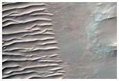
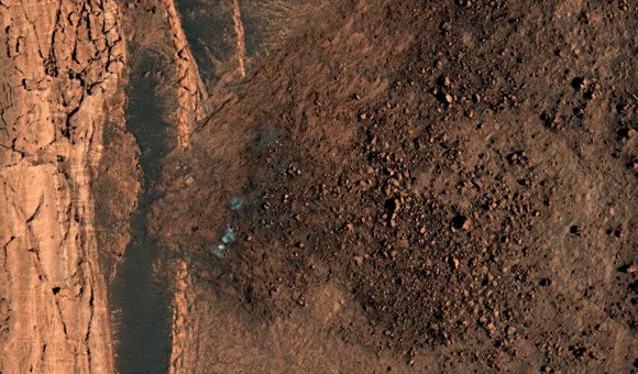
Possible small Volcano or Pingo in Chasma Boreale.

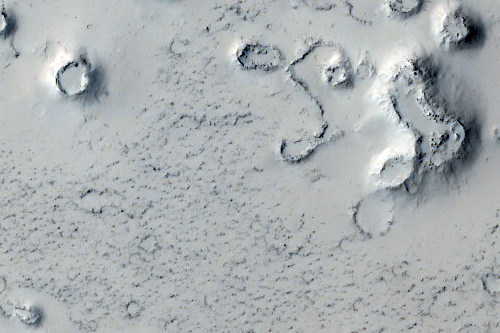
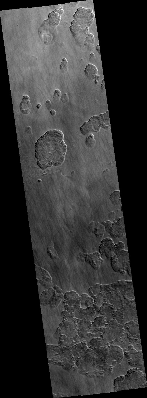
A quick look, seems to suggest a very heavily eroded impact crater, though later on, when I look properly, may think otherwise.

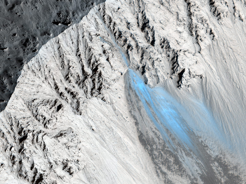
Tonight when I am home, I will make crops & enlargements.

Andrew Brown.
 
3

3488

Guest
Some enlarged, crops as promised earlier. Clickable thumbnails.

MRO HiRISE obtained the observations on: Sunday 2nd May 2010. It was only 11 sols before the Martian northern Summer Solstice. A lot of ice is still present on north facing slopes. At midsol (noon) here, the Sun only 44% as strong as on Earth, only climbs 34 degrees above the southern horizon.

Latitude 80 degrees 18' North. Longitude 308 deg 48' East (51 deg 12' West).

Looks like an eroded impact crater now IMO.

Possible Pingo or small volcano in its entirety, my choice accepted by HiRISE team. It is approx 2 KM wide.


Southern 1 KM section.


Dead Centre area approx 100 metres across. Tundra type ground similar to that encountered by Phoenix Mars Lander, though this is much firther north, just above 80 degrees North.


Colour section approx 250 metres wide just to the east, that actual floor of Chasma Boreale. Very similar again to the are in Scandia Colles that Phoenix Mars Lander landed.


Interesting patterned section approx 250 metres wide between two basalt sand dunes in Chasma Boreale close to the eastern rim of the circular feature.


Another intersting area approx 250 metres wide, close to the above shot.


Northern portion of basalt sand dune on martian tundra in Chasma Boreale. Frost still hangs on.


Looks like an interesting & photogenic location.

Andrew Brown.
 
3

3488

Guest
Gravity_Ray":233z0pch said:
Is that water ice or CO2 ice?

Hi Gravity_Ray.

I suspect Water Ice. If it was CO2 ice, I would suspect the water ice frost to still be blanketing the entire scene. It is difficult to know for sure without the temperature data, but I suspect H2O ice.

There may be smaller patches of CO2 ice within these white patches. Would love to see some IR data.

Andrew Brown.
 
B

bearack

Guest
Might this change some opinions of how volcanically active the planet really is?
 
E

EarthlingX

Guest
http://www.universetoday.com : Get Your Mars (and HiRISE) Fix With Over 600 New Images
June 9th, 2010

Written by Nancy Atkinson

Mmmm, Mars. And lots of it, too! The team from one of our all-time favorite scientific instruments, the HiRISE camera on the Mars Reconnaissance Orbiter has just released a big batch of images taken from April 5 to May 6, 2010, and they are now available on NASA's Planetary Data System and on the HiRISE website. This includes over six hundred recent observations of the Mars landscape as seen from orbit, including scenes of sinuous gullies, geometrical ridges, steep cliffs, or these unusual dunes, above, in Desher Vallis.


Possible Phyllosilicates in Her Desher Vallis. Credit: NASA/JPL/University of Arizona

Each of the 629 new images cover an area of several square miles on Mars and reveals details as small as desks.


Possible Cone Field in Phlegra Dorsa. Credit: NASA/JPL/University of Arizona

HiRISE is made of awesome, and is one of six instruments on MRO,which reached Mars in 2006.
 
3

3488

Guest
silylene":2zdi3v2w said:
Very cool, Andrew

Thanks silylene,

It is a pleasure. I noticed way back when the first MGS MOLA map of Mars was produced, that there where two curious looking 'mounds' on the floor of Chasma Boreale. One at the mouth ( the one on this thread) & another further up the chasm to the north east. MRO HiRISE team have accepted both requests. The second one is certainly an impact crater & I though that it would be interesting as the impact may have excavated material from under the canyon floor & the ejecta may give further clues as to the ancient climate of this area on Mars.

This one however was more mysterious of the two. It was certainly a feature, but I could not decide what it was. It could have either been a Pingo (an upwelling of tundra as ice expands in the regolith) or indeed a small volcano. However, these HiRISE observations seem to show that it is neither, looks like an eroded ancient impact crater instead. A little disappointing in many ways, but it is a gorgeous feature, with those dark basalt dunes slowly marching across. If I did not ask, we would never know. Looking forward to the other feature being observed.

I have also asked for:

1). Highest point on Olympus Mons (by default the highest point on Mars) with caldera wall & a small sample of adjoining caldera floor.

2). Lowest point of Coronae Scopulus @ approx - 9,000 metres below the datum line.

3). Sample of SE summit caldera wall & nested caldera floor of Ascraeus Mons.

4). Small Crater in Chasma Boreale.

All have been accepted.

bearack":2zdi3v2w said:
Might this change some opinions of how volcanically active the planet really is?

Hi Tim,

I did hope so, but it looks like an old eroded impact crater, rather than volcanic. I did also ask for a CRISM co observation too. That should reveal a little more.

Andrew Brown.
 
3

3488

Guest
A few more crops of my HiRISE suggestion.

It is a beautiful location for sure, the Martian tundra, the black basalt sand dunes, some with frosting. The crops are of varying zooms, but cover no more than 1.5 KM, some are only about 200 metres across. It's an area on Mars relatively little is known.


Andrew Brown.
 
E

EarthlingX

Guest
This looks like a dried mud :


Is it ?

How old would this be ?


Nice job, btw :cool:
 
E

EarthlingX

Guest
I found this weird thing :

DustDevilTracksAndScallopedTerrainSouthOfTheHellasRegion_HiRISE_RGB_PSP_004168_1220_02.jpg


in this image, RGB, little bellow the half of it :

http://www.uahirise.org : Dust Devil Tracks and Scalloped Terrain South of the Hellas Region (PSP_004168_1220)

Dust Devil Tracks and Scalloped Terrain South of the Hellas Region (PSP_004168_1220)
Credit: NASA/JPL/University of Arizona
...
The large depressions have scalloped edges and appear to have formed from multiple smaller depressions, also with scalloped edges, that have coalesced together. Scalloped pits such as these are typical features of the mid-latitude mantle and are most commonly found at approximately 55 degrees North and South latitude. The presence of scalloped pits has led to hypotheses of the removal of subsurface material, possibly interstitial ice, by sublimation (the process of solid material going directly to a gaseous state).
...

What do you think this is ? Gas ?
 
E

EarthlingX

Guest
www.universetoday.com : More Recent Landslides Spotted on Mars
Oct 14th, 2010

by Nancy Atkinson


Thanks to the Mars Reconnaisance Orbiter and the on-board HiRISE camera, scientists are able to monitor Mars for changes taking place on the landscape. They do this by comparing older images with newer ones, and also by seeing “fresh” features — like this recent landslide in Zunil Crater. “The color and albedo patterns indicate that a landslide occurred here very recently–too recently to have been re-covered by dust,” writes Alfred McEwen, principal investigator of HiRISE, writing on the camera’s website. “Looking for changes such as this will help us to better understand active processes.” McEwen said the landslide could have been triggered by a Marsquake or a small impact event.”

See more recent landslides below:

This landslide was spotted by Stu Atkinson; boulders and debris are below a steep north polar boundary scarp. Credit: NASA/JPL/University of Arizona
...
 
E

EarthlingX

Guest
www.universetoday.com : The Dark Dunes of Mars
Nov 1st, 2010

by Nancy Atkinson


Proctor Crater Dune Field on Mars. Credit: NASA/JPL/University of Arizona

I just got lost on Mars. I saw this intriguing image, above, on the HiRISE camera website, and ended up spending a large chunk of my morning just wandering through the dunes of Mars — actually wandering through images of dunes on Mars. These striking features have to be one of the most intriguing areas of study on the Red Planet since they are one of the most dynamic geologic processes going on currently on Mars.

The dark dunes are composed of basaltic sand, and scientists believe the dunes in the image above have formed in response to fall and winter westerly winds. Also superimposed on their surface are smaller secondary dunes that are commonly seen on terrestrial dunes of this size.

See below for more intriguing dunes on Mars that I came across in my wanderings…
...

Chocolate dunes? Credit: NASA/JPL/University of Arizona
...

Falling Material Kicks Up Cloud of Dust on Dunes. Credit: NASA/JPL/University of Arizona
...
 
3

3488

Guest
Second suggestion of mine has just been released. As it is getting late here, thought I would just for now copy over the message from HiRISE & activated the link.

I am too tired to really look right now, but already I can see it is a very degraded crater in the polar terrain within Chasma Boreale. Quite picturesque like my last suggestion.

Dear Andrew Brown,

HiRISE images have been acquired and released for one or more of your suggested targets. The data are now available on the HiRISE website at the urls listed below.

Note: The descriptions you entered for your suggested targets are listed below, however, the official image descriptions maintained by the HiRISE Team may differ. The HiRISE Team tries to make the official image descriptions consistent with the current Mars nomenclature and the geologic features found in the images.

Suggestion ID Observation URL Release Status
44720
http://www.uahirise.org/ESP_019229_2630 Initial Release Description: Small Crater in Chasma Boreale.

Additional Note: Our target retirement software will retire a target suggestion if the center of the suggestion falls inside the footprint of the retiring observation, or if the center of the observation falls inside the suggestion footprint. This system is not intended to guarantee to complete coverage of a target, but usually provides enough coverage to meet the science objectives. If your target did not get adequate coverage by the retiring observation, you may submit a new target suggestion to cover the region missed by the observation.

Thank you for your support in making HiRISE a successful mission and we hope you enjoy the images. If you have questions about the acquired images, please use the contact form on the HiRISE website: http://www.uahirise.org/contact/

Thank you,

The HiRISE Team

Andrew Brown.
 
3

3488

Guest
My 2nd HiRISE suggestion is a small 4 KM wide degraded crater in the martian Arctic canyon Chasma Boreale.

A few crops from the HiRISE IAS viewer. Clickable thumbnails to full sized images.


Andrew Brown.
 
Status
Not open for further replies.

TRENDING THREADS

Latest posts