LRO Lunar Reconnaissance Orbiter Mission.

Page 5 - Seeking answers about space? Join the Space community: the premier source of space exploration, innovation, and astronomy news, chronicling (and celebrating) humanity's ongoing expansion across the final frontier.
Status
Not open for further replies.
M

MeteorWayne

Guest
Re: LRO/LCROSS Mission

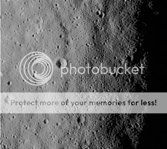
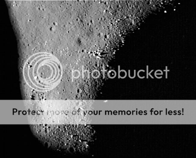
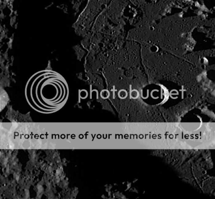
Very interesting linear striations in the 3rd and 4th images. While the ones in the 3rd could be scan line artifacts, the curved ones in the 4th surely aren't. I'm scratchin' my head!
 
3

3488

Guest
Re: LRO/LCROSS Mission

MeteorWayne":3d5rely7 said:
Very interesting linear striations in the 3rd and 4th images. While the ones in the 3rd could be scan line artifacts, the curved ones in the 4th surely aren't. I'm scratchin' my head!

Thank you Wayne, I'm glad you like these images.

They take time to do, i.e. find interesting frames, then zoom in & find interesting terrain to crop, reorientate them if needed, enlarge (these on this thread only a little), sharpen, adjust contrast if needed (these have not really needed much), then post them to a hosting site, then link them to here.

I have taken on board what you have said & have taken a closer look myself. In image #3 IMO, the striations look real, more or less following a fairly level patch of ground. That patch of ground along with the others except image #1 are 1.86 KM / 1.15 miles wide, so really it is a small area (image #1 is approx 10 KM / 6.21 miles wide).

What I find really interesting about yesterday's (Tsinger Crater) & today's offerings is that IIRC these are the highest resolution images of the lunar farside obtained. Also today, so far north in the lunar arctic, almost 87 North & on the far side to boot.

The Apollo CM & the five pre Apollo lunar orbiters all had perilune over the nearside equatorial regions, because obviously that was where the Apollo landing sites were (Apollo 15 landed furthest from the lunar equator @ approx 26 deg 6' North), Clementine, mapped the moon in it's entirety at the same resolution, though not nearly as sharp as these.

The possible exception to date is the Kaguya / Selene from JAXA with the Terrain Camera, though I do not think JAXA has released everything as yet.

However, when LRO reaches the science orbit next month, then even these images will appear crude & low resolution to the LROC NAC.

Hopefully we will see a full list of intended targets for said instrument, though the few already announced are very exciting & interesting. For me the Ina D caldera really does it, though the other selections are pretty amazing.

Below. Ina D caldera which is 3 KM wide as imaged by Apollo 17 CM America.
Ina_AS17-M-1518_LTVT.JPG


Whilst many people seem excited about LROC NAC imagery of the Apollo sites & yes I agree that it will be great to see some of our hardware again, some it left behind by the Apollo astronauts, after so long, but for me the biggest draw, is the fact we will get to see many locations on the moon at a level of detail, never accomplished before.

Andrew Brown.
 
3

3488

Guest
Re: LRO/LCROSS Mission

A quick one today, as there are no updates today & the fact that I am not feeling too well, a crop showing an area only 833 metres across.

This is from the first LROC NAC image released last week, the area a few KM east of Hell E Crater in the Deslandres Impact region, south of Mare Nubium. 34.4 South. 6 West.
344S60WLRO.jpg


The striations in the very low dawn sun are striking indeed.

Hopefully tomorrow I will be back feeling better.

Andrew Brown.
 
3

3488

Guest
Re: LRO/LCROSS Mission

MeteorWayne":31heks9s said:

Thanks Wayne, that's pretty awesome!!!!!!!!!!!

LRO LROC has temporarily ceased lunar observations as a final bakeout of volatiles is carried out.

This is a planned activity, so there is nothing wrong, in fact the opposite is true, all systems are operating well & the test images are better than expected. LRO will restart lunar observations with LROC on Sunday.

Andrew Brown.
 
3

3488

Guest
Re: LRO/LCROSS Mission

Crops from new update today.

Fractured floor of far side Compton Crater at 55.56 North. 104.26 West. Resolution of these are all 1.72 metres.

A tiny area only 1,030 metres across showing tiny craters & boulders.
ComptonCraterfloor1030metrewidecrop.jpg


A 908 metre wide crop showing the summit of the central peak of lunar far side Compton Crater.
ComptonCrater908metrewidecropshowin.jpg


A 1,019 metre wide crop showing boulders on the rim of a tiny crater on the floor of far side Compton Crater.
ComptonCraterfloor1019metrewidecrop.jpg


A 1,025 metre wide crop showing more boulders in the setting sun & another small crater.
ComptonCraterfloor1025metrewidecrop.jpg


A 1,028 metre wide crop showing boulders on the edge of a shadowed fracture.
ComptonCraterfloor1028metrewidecrop.jpg


An 846 metre wide crop showing a few boulders on the edge of a junction of two fratures on the floor of far side Compton Crater.
ComptonCraterfloor846metrewidecropb.jpg


Andrew Brown.
 
3

3488

Guest
Re: LRO/LCROSS Mission

A few more crops from today's release. It was an interesting one today. Also I am quite certain that never before have we seen detail as sharp as this from the Lunar Farside.


Below a 8.4 KM wide section of far side Compton Crater
cover_1000.png


1,032 metre wide crop with small crater & boulders. Edge of one of the fractures is visible.
ComptonCraterfloor1032metrewidecrop.jpg


1,041 metre wide crop with small crater & boulders. Edge of a crater is visible at bottom.
ComptonCraterfloor1041metrewidecrop.jpg


Giving this some more thought, I wish for the following ten targets to be looked at with the LROC NAC, in addition to the six that Wayne found in Nature. I think they represent a great grab bag of varying terrains on the Moon. Perhaps others here on SDC could come up with others. I would be happy to post them on the LRO NASA comment section on the NASA LRO site as I have done with the following. No doubt I will come up with some more also.

1) Brayley G, the curious rimless "kidney shaped" depression.
2) Crater Copernicus, lava flooded floor & central mountains.
3) Farside Crater Tsiolkovskiy, as Crater Copernicus above.
4) Arctuate Rilles in Rimae Hippalus.
5) Valentine Dome.
6) Lacus Autumni, Lacus Veris & central Mare Orientale.
7) Sample shots of Mare Crisium, base of rim mountains & central area.
8) Sample shots of far side Mare Moscoviense as Mare Crisium above.
9) South Pole Aitken Basin deepest points.
10) Peaks of enternal light south polar region.

Andrew Brown.
 
A

aphh

Guest
Re: LRO/LCROSS Mission

> Small hill with boulders to the south of Mare Frigoris. 56.64 North. 7.16 West.

Are you sure those are boulders? Looks like a partially hidden moon base to me...

Seriously, these are great images already. It starts to look more and more like Space Odyssey 2001, the movie. It's almost like being there on the Moon.
 
D

davcbow

Guest
Re: LRO/LCROSS Mission

First time poster, Awesome pictures folks, thanks for the effort, NASA dont seem to be posting any new stuff on their web sites.... :D
 
M

MeteorWayne

Guest
Re: LRO/LCROSS Mission

Where do you think Andrew gets his images?
 
D

davcbow

Guest
Re: LRO/LCROSS Mission

I go to NASA everyday looking for Pic's at the Nasa main LRO/LCross sites and at the Goddard LRO/LCross sites, if the URL is a big secret could you please post it? :D
 
M

MeteorWayne

Guest
Re: LRO/LCROSS Mission

davcbow":3i2jyqzu said:
I go to NASA everyday looking for Pic's at the Nasa main LRO/LCross sites and at the Goddard LRO/LCross sites, if the URL is a big secret could you please post it? :D

I'll let Andrew answer, he's our image guru :shock: :p
 
3

3488

Guest
Re: LRO/LCROSS Mission

davcbow":3i8uepxm said:
I go to NASA everyday looking for Pic's at the Nasa main LRO/LCross sites and at the Goddard LRO/LCross sites, if the URL is a big secret could you please post it? :D

Hi davchow,

The link is below to the LROC site. Here they post up the new releases, which do not appear on the general NASA LRO/LCROSS sites or the Goddard Spaceflight LRO/LCROSS site.

LROC site.

The LROC site uses Zoomify so can really get close & can move around the frame.

The images I post here are the result of a lengthy process.

1). Find image.
2). Zoomify it right in (mostly).
3). Find any interesting features only readily visible at high resolution, I.e the hill with boulders.
4). Do a screen dump.
5). Paste screen onto image software, i.e Adobe Photoshop, Ability PhotoPaint, etc.
6). Crop image (get rid of the other screen clutter that copied over) & find out how many pixels across it is. NASA gives the resolution, i.e 1.72 metres. If image is 600 pixels @ 1.72 metres = image represents 1,032 metres across.
7). Image may need rotating 180 degrees so north is top (the lunar near side ones were south at top, Lunar Farside were north at top).

8). I enlarged each image slightly using 7 point interpolation (so the enlargement does not pixelate).
9). Sharpen image, I use the sharpen up twice mode then unsharp mask.
10). Save using maximum resolution. I do not compress them.

Then.
11). Open an image hosting site, I use Photobucket.
12). Uplink image from my hard drive.
13). Copy link over to SDC.
14). Post link using

15). Save message.

I do keep all images I create as part of my vast growing selection of solar system images. These images I post here are not on any NASA site.

Andrew Brown.
 
3

3488

Guest
Re: LRO/LCROSS Mission

MeteorWayne":1j7o50ia said:
davcbow":1j7o50ia said:
I go to NASA everyday looking for Pic's at the Nasa main LRO/LCross sites and at the Goddard LRO/LCross sites, if the URL is a big secret could you please post it? :D

I'll let Andrew answer, he's our image guru :shock: :p

Thank you very much Wayne for you undying support of my efforts. It is really hugely appreciated my freind. :mrgreen: :mrgreen:

Andrew Brown.
 
3

3488

Guest
Re: LRO/LCROSS Mission

First Mini RF (Mini Radio Frequency) imagery of the LRO mission. Both areas are conentrated to within 10 degrees of each pole.
minirf-poles.jpg


When LRO reaches the optimum science orbit next month, future such scans will be of better resolution.

Andrew Brown.
 
D

davcbow

Guest
Re: LRO/LCROSS Mission

Thanks a ton Andrew, you have solved a big mystery for me.... very much appreciated..... :D
 
3

3488

Guest
Re: LRO/LCROSS Mission

davcbow":24p3d812 said:
Thanks a ton Andrew, you have solved a big mystery for me.... very much appreciated..... :D

You are very welcome davvbow. I hope you like my efforts!!!!!

BTW LRO has yesterday & today passed over the Apollo 11, 15, 16 & 17 sites. They in turn were very close to the afternoon sunset terminator, though I think the focus on the Apollo sites is a distraction in some ways, though it will be great to see the Apollo hardware again, in some form.

As I was typing this LRO was passing north to south over Mare Frigoris.

For those interested there is a Where is LRO page.

I have been working on a few more.

1,028 metre wide section with small crater approx 800 metres across on floor of far side Compton Crater at 55.56 North. 104.26 West. Resolution 1.72 metres.
ComptonCraterfloor1028metrewidec-1.jpg


1,028 metre wide section with hummocky terrain on floor of far side Compton Crater at 55.56 North. 104.26 West. Resolution 1.72 metres.
ComptonCraterfloor1028metrewidec-2.jpg


1,026 metre wide section with small crater approx 900 metres & boulders across on floor of far side Compton Crater at 55.56 North. 104.26 West. Resolution 1.72 metres.
ComptonCraterfloor1026metrewidecrop.jpg


987 metre wide section with junction of fracture (left) & crater (right) with boulders across on floor of far side Compton Crater at 55.56 North. 104.26 West. Resolution 1.72 metres.
ComptonCraterfloor987metrewidecropb.jpg


Back to the north polar near side.
1,099 metre wide area showing a Ghost Crater barely visible. Northwest of Anaxagoras A. 72.21 North 9.79 West. Resolution is 1.85 Metres.
NWofAnaxagorasA1099metresectioncrop.jpg


1,108 metre wide area showing a terrain with a conical outcrop, boulders & small craters. Northwest of Anaxagoras A. 72.21 North 9.79 West. Resolution is 1.85 Metres.
NWofAnaxagorasA1108metreareaoutcrop.jpg


1,108 metre wide area showing a general rolling terrain with boulders & small craters. Northwest of Anaxagoras A. 72.21 North 9.79 West. Resolution is 1.85 Metres.
NWofAnaxagorasA1108metresectioncrop.jpg


1,114 metre wide area showing a general rolling terrain with curious streaking SW to NE, boulders & small craters. Northwest of Anaxagoras A. 72.21 North 9.79 West. Resolution is 1.85 Metres.
NWofAnaxagorasA1114metresectioncrop.jpg


Hopefully we'll be seeing some new stuff soon.

Andrew Brown.
 
3

3488

Guest
Re: LRO/LCROSS Mission

This just in literally just now.

Wide Angle Camera 160 KM wide view centred on 35.7 North, 79 East.

Portion of 170 KM wide Gauss Crater with fractured floor with 80 KM wide Hahn Crater in the bottom right. Gauss Crater clearly has a lava flooded floor that later cracked, much like the close NAC crops I have made of Compton Crater.

An 82.64 KM wide crop of western Gauss Crater clearly showing the fractured floor. Resolution 155 metres.
8264wideareaofwesternGaussCrater357.jpg


Andrew Brown.
 
A

aphh

Guest
Re: LRO/LCROSS Mission

Does LRO have also infra-red sensor like LCROSS? If there's any thermal variations in those craters, infra-red would reveal it.
 
M

MeteorWayne

Guest
Re: LRO/LCROSS Mission

Instrument list from page 2 of the thread:

The LRO Primary Science Mission lasts one year in that 50 km polar orbit. During that time it will cover the surface of the moon 26 times. The primary mission is focused on finding and collecting data on sites for future human manned exploration. Plenty of science will be collected as well, but the first year is dedicated to that purpose. The extended mission beyond year 1 will be focused more on scientific observations.

There are 7 instruments on LRO, here's the list and a brief description.

CRaTER -A radiation sensor to examine the environment for radiation fluxes and hazards. It is the only direct measurement device, all the rest are remote sensors.

Diviner- Infrared Radiometer; to collect temperature measurements of the lunar surfaceLOLA- Laser Altimeter. It will send laser light to the surface 28 times a second for the life of the mission to get detailed topography of the lunar surface.

LROC- The visible wavelength cameras. There is a wide angle camera (~100 meter resolution) and a Narrow Angle Camera (~ 50 cm, 1 1/2 foot, resolution).

LAMP- UV Spectrometer- will look for water frost and mineral composition of the lunar surface.

LEND- Neutron Detector- to examine the Hydrogen and other composition of the surface

Mini RF- a technology test, it is an advanced Synthetic Apeture Radar.
 
3

3488

Guest
Re: LRO/LCROSS Mission

Also DIVINER is the only one of the seven instruments that can swivel independently. All of the others are in a fixed position.

IIRC DIVINER, LAMP & LROC at times will be used simultaneously as the IR, UV & Visible data can then be matched precisely in the same time frame. This will only be utilised in certain cases as this would take a lot of bandwidth.

Below an enlarged 72.2 KM crop showing Hahn Crater. Resolution 155 metres. This crater looks very similar to Copernicus is many respects with the terraced walls & vcentral peak. Wonder if the NAC was used as well. NAC imagery of the floor of Guass Crater would be interesting.
7223widecropshowingHahnCrater357N79.jpg


Andrew Brown.
 
3

3488

Guest
Re: LRO/LCROSS Mission

LRO just passed over the Surveyor 7 landing site & Tycho Crater.

This presents a great opportunity as to how historic landers & orbiters can compliment the results from current spacecraft like LRO.

Surveyor 7 remains to date the highest latitude soft landing to date, returning landscape imagery of which Surveyor 7's was of extremely high quality & other scientific data from furthest from the lunar equator than any other lunar landing mission, including Apollo. Surveyor 7 landed approx 30 KM north of Tycho, Latitude 41 South, longitude 349 East / 11 West (dependent on your preferences for measuring longitude).

Below Surveyor 7 panorama. LRO passed over this site this morning.
surveyor7_moon.jpg


I hope that the LROC NAC was active during this pass. The site was close to the PM terminator, so any shadow cast by the historic lander should have been seeable.

Andrew Brown.
 
B

brandbll

Guest
Re: LRO/LCROSS Mission

3488":38eectkr said:
LRO just passed over the Surveyor 7 landing site & Tycho Crater.

This presents a great opportunity as to how historic landers & orbiters can compliment the results from current spacecraft like LRO.

Surveyor 7 remains to date the highest latitude soft landing to date, returning landscape imagery of which Surveyor 7's was of extremely high quality & other scientific data from furthest from the lunar equator than any other lunar landing mission, including Apollo. Surveyor 7 landed approx 30 KM north of Tycho, Latitude 41 South, longitude 349 East / 11 West (dependent on your preferences for measuring longitude).

Below Surveyor 7 panorama. LRO passed over this site this morning.
surveyor7_moon.jpg


I hope that the LROC NAC was active during this pass. The site was close to the PM terminator, so any shadow cast by the historic lander should have been seeable.

Andrew Brown.

That will be really cool if they can see that. Are either of the two Russian Lunar Rovers big enough to see? I think it would be interesting to see the crash site of SMART-1 spacecraft.
 
A

aphh

Guest
Re: LRO/LCROSS Mission

brandbll":w6ltf8k1 said:
That will be really cool if they can see that. Are either of the two Russian Lunar Rovers big enough to see? I think it would be interesting to see the crash site of SMART-1 spacecraft.

Lunar Rovers should show up the way Opportunity was seen at Victoria crater in Mars by MRO. It remains to be seen whether images of historic landers will be released before the orbit has been lowered to the intended altitude.

Here's Opportunity at Victoria crater (can you locate the rover):

http://upload.wikimedia.org/wikipedia/c ... HiRise.jpg

So it's not going to be spectacular views of the moon landers, but atleast they should show in the images pretty well.
 
M

MeteorWayne

Guest
Re: LRO/LCROSS Mission

http://www.space.com/missionlaunches/09 ... -site.html


NASA's sharp-eyed Lunar Reconnaissance Orbiter is gearing up to look down on the Apollo 11 landing site – the location of the first human foray to the moon 40 years ago this month.

Along with carrying out lunar science jobs, the moon-circling probe in coming days, weeks and months will photograph selected lunar targets, zooming in on a short list of Apollo landing locales to see the final resting spots of robotic spacecraft, moon buggy tracks and crashed rocket stages, SPACE.com has learned.

The Lunar Reconnaissance Orbiter (LRO) is already on duty and using its LRO Camera, dubbed LROC for short.

The landed Eagle

One large item that should be easy to spot is Apollo 11's Eagle descent stage, left behind after Neil Armstrong and Buzz Aldrin rocketed away from Tranquility Base.

For the Apollo 11 site, "you will definitely see this square thing sitting on surface," said LROC's Principal Investigator, Mark Robinson of Arizona State University in Tempe. At low sun it's likely that the lander legs will cast shadows. "It will be unambiguous that the descent stage is sitting there," Robinson said.

The descent stages of other Apollo missions should be visible, too. And the orbiter will look for Apollo Lunar Surface Experiment Packages (ALSEP) – an array of scientific devices deployed on the lunar surface by Apollo moonwalkers.

"I know we'll see the descent stages...and I know we'll be able to find the ALSEPs," Robinson told SPACE.com. "You'll see things sitting on surface." Churned-up lunar regolith, the tracks of the three lunar rovers used during the Apollo program, should also be visible.

Lunar archaeologists, interested in making the Apollo 11 site a National Historic Landmark, hope the planned photos will answer some of these longstanding questions: What is the condition of Tranquility Base after 40 years? Was the American flag blown over on the Eagle's ascent and is it now a bleached skeleton? What are the relatively long term effects of the lunar environment on human artifacts?
 
Status
Not open for further replies.

TRENDING THREADS