LRO Lunar Reconnaissance Orbiter Mission.

Page 7 - Seeking answers about space? Join the Space community: the premier source of space exploration, innovation, and astronomy news, chronicling (and celebrating) humanity's ongoing expansion across the final frontier.
Status
Not open for further replies.
3

3488

Guest
Re: LRO/LCROSS Mission

4.5 KM long Crater Chain some 525 KM south east of Far Side Crater Giordano Bruno (though is viewable from Earth when libration is favourable, but mostly it is unobservable), likely to be the source.

The crater at the bottom right is 340 metres across.
45KMlongCraterChain525SEofGiordanoB.jpg


My own crop & enlargement of the final 2.5 KM section.
25KMSEportionof45KMlongCraterChain5.jpg


Andrew Brown.
 
3

3488

Guest
Re: LRO/LCROSS Mission

After a cessation, there is a new update on the LRO LROC site.

The area featured is a tiny section of Schroter's Valley / Vallis Schröteri on the Aristarchus Plateau. Schroter's Valley is a collapsed lava tube on the moon. The Aristarchus region has many complex volcanic features, including Schroter's Valley / Vallis Schröteri & the Aristarchus Plateau is also home to pyroclastic deposits & some iron rich regoliths.

The image & my crops below concentrate on the 'Inner Rille' a narrow rille that runs along the floor of the much wider main rille.

NASA image of a 1.74 KM section.
AristarchusPlateauInnerRilleSchrote.png


Below my own crops & enlargements.

7 KM wide area. Schroter's Valley, Aristarchus Plateau. 25.8 North. 50.6 West.
7KMwideareaAristarchusPlateauSchrot.jpg


877 metre wide area with large boulders. Schroter's Valley, Aristarchus Plateau. 25.8 North. 50.6 West.
877MetrewideareabouldersAristarchus.jpg


877 metre wide section of Inner Rille wall with boulders. Schroter's Valley, Aristarchus Plateau. 25.8 North. 50.6 West.
877MetrewideareaAristarchusPlateauS.jpg


875 metre wide bend of Inner Rille wall with boulders. Looks a lot like Hadley Rille at the Apollo 15 site. Schroter's Valley, Aristarchus Plateau. 25.8 North. 50.6 West.
875MetrewideareaAristarchusPlateauS.jpg


873 metre wide area with a large rolled boulder with it's track. Schroter's Valley, Aristarchus Plateau. 25.8 North. 50.6 West.
873MetrewideareaAristarchusPlateauS.jpg


Impact of LCROSS on: Friday 9th October 2009.

50 Days.
15 Hours.
24 Minutes.
15 Seconds.

Andrew Brown.
 
3

3488

Guest
Re: LRO/LCROSS Mission

LRO has reimaged the Apollo 14 site in Fra Mauro & also have resolved the tracks made by Alan Shepherd & Edgar Mitchell, pulling the MET cart.

Also it is apparent how close they got to the rim of Cone Crater before giving up & turning back, they got to about 30 metres of the rim, but did not realise it at the time.

The sun this time was 24 degrees higher up than last time, so better albedo variations & fewer shadows, but the sun was not high enough to wash out the scene.

Unannotated image here

Annotated image here

My own crop & enlargement.
Apollo14siteLMAntaresAlseptrackssec.jpg


My own crop & enlargement labled.
Apollo14siteLMAntaresAlseptracks-1.jpg


My own crop & enlargement of Cone Crater, which Alan Shepherd & Edgar Mitchell got to within 30 metres of the rim, before they turned back after thinking that they had gone wrong & time was running out regarding oxygen & water in their suits.
Apollo14siteConeCraterLRO.jpg


Also just found this, an LRO LROC NAC image of the shadowy 10 KM wide north polar Erlanger Crater @ 87 North, 28.6 East.
Large Image Here.
10KMwideErlangerCraterErlangersmall.jpg


Impact of LCROSS on: Friday 9th October 2009.

48 Days.
16 Hours.
35 Minutes.
15 Seconds.

Andrew Brown.
 
3

3488

Guest
Re: LRO/LCROSS Mission

Interesting update. Impact melt on floor of the Lunar Farside Necho Crater @ 5 South, 123.6 East.
The cracks are 10 to 15 metres wide. Necho Crater is thought to be approximately the same age as the well known Copernicus Crater @ approx 800 million years.

Below NASA release of a 1.04 KM wide area of the cracked impact melt within the Lunar Far Side Necho Crater.
FI_Cracks_M103703826LE2_1000px.png


My Crops & enlargements below.

610 metre wide section of floor of the Lunar Farside Necho Crater @ 5 South, 123.6 East.
610metrewidesectiononfloorNechoCrat.jpg


609 metre wide section of base of NE crater wall on floor of the Lunar Farside Necho Crater @ 5 South, 123.6 East.
609metrewidesectiononfloorNechoCrat.jpg


604 metre wide section of floor with large boulders of the Lunar Farside Necho Crater @ 5 South, 123.6 East.
604metrewidesectiononfloorNechoCrat.jpg


612 metre wide section of floor with hummocky terrain & boulders of the Lunar Farside Necho Crater @ 5 South, 123.6 East.
612metrewidesectiononfloorNechoCrat.jpg


610 metre wide section of floor with what may be a lava dome. Lunar Farside Necho Crater @ 5 South, 123.6 East.
610metrewidesectiononfloorNechoC-1.jpg


612 metre wide section of floor with cracked lava impact melt. Lunar Farside Necho Crater @ 5 South, 123.6 East.
612metrewidesectiononfracturedimpac.jpg


Impact of LCROSS on: Friday 9th October 2009.

47 Days.
12 Hours.
59 Minutes.
45 Seconds.

Andrew Brown.
 
C

CalliArcale

Guest
Re: LRO/LCROSS Mission

Whoa. That cracked lava field looks almost *terrestrial*. Wild!
 
3

3488

Guest
Re: LRO/LCROSS Mission

CalliArcale":34i6wgfw said:
Whoa. That cracked lava field looks almost *terrestrial*. Wild!

Hi Calli,

I agree, it looks a lot like dried out cracked mud, though lava at that resolution would look like that with lunar dust in places smoothing out the appearance.

I really like this release, it's probably in many ways my favourite one to date, though they have all shown us new features, & the stark barren beauty of the lunar terrain.

I have created some more crops & enlargements from the long image strip of Necho Crater on the Moon's far side.

610 metre wide section of floor showing a transition from a cracked to a smooth area of the Lunar Farside Necho Crater @ 5 South, 123.6 East.
610metrewidesectiononfloorwithbould.jpg


608 metre wide section of floor showing some massive boulders, some approx 50 metres across. Lunar Farside Necho Crater @ 5 South, 123.6 East.
608metrewidesectionwithlargeboul-1.jpg


608 metre wide section of floor showing some giant boulders, with a smoother area & further lava cracking. Lunar Farside Necho Crater @ 5 South, 123.6 East.
608metrewidesectionwithlargeboul-2.jpg


608 metre wide section of an area out side the N E rim showing a curious split domed feature. A secondary impact???? Lunar Farside Necho Crater @ 5 South, 123.6 East.
608metrewidesectionwithlargeboulder.jpg


Impact of LCROSS on: Friday 9th October 2009.

45 Days.
16 Hours.
33 Minutes.
15 Seconds.

Andrew Brown.
 
3

3488

Guest
Re: LRO/LCROSS Mission

Today's update.
LRO LROC NAC perspective image of the Apollo 16 site in Descartes / Cayley highlands. The crater labled A is South Ray Crater & is approx 750 metres wide.
This image has been electronically tilted from a 3D nadir view
as16_orthophoto.png


I will be back shorly with some snippetts from yesterday's fascinating update.

Just a note, the LCROSS craft is dangerously low on fuel, though should still complete the mission successfully after a malfunction recovery, used far more fuel than anticipated. Fuel margins are now desperately low. I hope it's not too serious.

Impact of LCROSS (hopefully) on: Friday 9th October 2009.

43 Days.
21 Hours.
14 Minutes.
15 Seconds.

Andrew Brown.
 
M

MeteorWayne

Guest
Re: LRO/LCROSS Mission

Thanx for the great image, and the not so great LCROSS update. Glad you caught that.

Wayne
 
3

3488

Guest
Re: LRO/LCROSS Mission

Hi Wayne,

You're very welcome. Hopefully the LCROSS situation is under control. The article suggested that the LCROSS star tracker lost the lock due to a high noise to signal ratio & LCROSS used up a lot of fuel reorientating.

Below some of my crops & enlargements.

A 1,137 metre section of the western rim of north polar Erlanger Crater. 87 North. 25.5 East.
1137metresectionWestrim10KMwideErla.jpg


A 1,088 metre section of the south western rim of north polar Erlanger Crater. 87 North. 25.5 East.
1088metresectionWestrim10KMwideErla.jpg


A 1,098 metre section of the northern rim of north polar Erlanger Crater. 87 North. 25.5 East. The sun was very low down, barely above the horizon.
1098metresectionNorthrim10KMwideErl.jpg


A 1,100 metre section of the inner northwestern wall of north polar Byrd Crater. 86.17 North. 25.5 East.
1100metresectionofNEinnerwall93KMwi.jpg


A 1,098 metre section of the floor of the north polar Byrd Crater. 86.17 North. 25.5 East.
1098metresectionoffloor93KMwideByrd.jpg


A 1,088 metre section of the floor with curious striations of the north polar Byrd Crater. 86.17 North. 25.5 East.
1088metresectionoffloor93KMwideByrd.jpg


Impact of LCROSS (hopefully) on: Friday 9th October 2009.

43 Days.
16 Hours.
20 Minutes.
15 Seconds.

Andrew Brown.
 
3

3488

Guest
Re: LRO/LCROSS Mission

Rather nice update.

Small crater 1 KM wide within the 225 lava flooded Balmer Basin on the near side of the moon, slightly smaller than the famous Meteor Crater in Arizona, USA. Like Meteor Crater, this crater is 'squarish' due to weakness & strengths in the impacted terrain.

NASA full size LROC image. Area is 1,302 metres wide.

2.5 KM wide crop of crater & rays. 18.65 South, 69.15 East. Balmer Basin.
1865South6915East1KMwideimpactcrate.jpg


1 KM wide view showing only the crater. 18.65 South, 69.15 East. Balmer Basin.
1865South6915East1KMwideimpactcr-1.jpg


540 metres wide view showing only the crater floor. 18.65 South, 69.15 East. Balmer Basin.
1865South6915East540etrewidesection.jpg


541 metres wide view showing rays & impact melt immediately north. 18.65 South, 69.15 East. Balmer Basin.
1865South6915East541metrewidesec-2.jpg


539 metres wide view showing rays & impact melt immediately east. 18.65 South, 69.15 East. Balmer Basin.
1865South6915East539metrewidesectio.jpg


541 metres wide view showing rays & impact melt immediately south. 18.65 South, 69.15 East. Balmer Basin.
1865South6915East541metrewidesec-1.jpg


541 metres wide view showing rays & impact melt immediately west. 18.65 South, 69.15 East. Balmer Basin.
1865South6915East541metrewidesectio.jpg


Small 289 metre wide crater approx 10 KM north of featured crater. 18.65 South, 69.15 East. Balmer Basin.
1865South6915East539metrewidesec-1.jpg


Impact of LCROSS (hopefully) on: Friday 9th October 2009.

38 Days.
14 Hours.
27 Minutes.
15 Seconds.

Andrew Brown.
 
3

3488

Guest
Re: LRO/LCROSS Mission

The LRO has taken amazing close up shots of the well known farside Tsiolkovskiy Crater. The Tsiolkovskiy Crater is probably one of the best known Lunar Farside features, even the most of the Apollo CMs took images of it.

LRO has now taken the sharpest images yet (90 CM resolution) by far of this fascinating crater & this observation was on a list of requests I sent to the LRO team. Whether or not my request prompted this, I do not know.

The NASA image linked to below, shows a 14.4 KM wide area of the central summit peaks of Tsiolkovskiy Crater, some 1,000 metres above the lava flooded crater floor, these mountains reflect the 'rebound' of the original terrain at impacts, before the floor flooded with molten rock.
14.4 KM wide area showing summit of central peak of lunar farside Tsiolkovsky Crater

Some crops of my own from the image strip.

A 520 metre wide section of the eastern most summit peak of Tsiolkovskiy Crater. 19.46 South. 128.73 East.
TsiolkovskiyCrater520Metrewideareab.jpg


A 519 metre wide section of boulders at base of the N W central mountain of Tsiolkovskiy Crater. 19.46 South. 128.73 East.
TsiolkovskiyCrater519Metrewideareab.jpg


A 520 metre wide section with boulders & their imprints as they rolled down the central mountains of Tsiolkovskiy Crater. 19.46 South. 128.73 East.
TsiolkovskiyCrater525Metrewidearaer.jpg


A 522 metre wide section with boulders at the base of the N E wall of Tsiolkovskiy Crater. 19.46 South. 128.73 East.
TsiolkovskiyCrater522Metrewideareab.jpg


A 522 metre wide section of the lava flooded floor of Tsiolkovskiy Crater,with a 'fresh' 135 metre wide crater. 19.46 South. 128.73 East.
TsiolkovskiyCrater525Metrewideareaw.jpg


Impact of LCROSS (hopefully) on: Friday 9th October 2009.

36 Days.
14 Hours.
46 Minutes.
30 Seconds.

Andrew Brown.
 
3

3488

Guest
Re: LRO/LCROSS Mission

I've just done three more crops from today's release. I have always found Tsiolkovsky Crater to be a very interesting feature, one worthy of more research.

A 524 metre wide section of sample area of lava flooded floor south of cental peak of Tsiolkovskiy Crater. 19.46 South. 128.73 East.
TsiolkovskiyCrater524Metrewidesampl.jpg


A 517 metre wide section of area of boulders at the southern base of the of cental peaks of Tsiolkovskiy Crater. 19.46 South. 128.73 East.
TsiolkovskiyCrater517Metrewideareab.jpg


A 522 metre wide section of area of giant boulders at the western edge of the summit of cental peaks of Tsiolkovskiy Crater, approx 1,000 metres above the lava flooded crater floor. 19.46 South. 128.73 East.
TsiolkovskiyCrater522Metrewidear-1.jpg


Impact of LCROSS (hopefully) on: Friday 9th October 2009.

36 Days.
12 Hours.
58 Minutes.
45 Seconds.

Andrew Brown.
 
3

3488

Guest
Re: LRO/LCROSS Mission

An annotated enlarged crop I did of the Apollo 12 site as seen from LRO.
Apollo12withLMIntrepidSurveyor3anno.jpg


An enlarged unlabled crop I did of the above. Surveyor Crater which is approx 200 metres wide has come out well, as well as the tracks from LM Intrepid left by Pete Conrad & Alan Bean radiating from LM Intrepid & one going to Surveyor 3.
Apollo12LMIntrepidSurveyor3Surveyor.jpg


Impact of LCROSS (hopefully) on: Friday 9th October 2009.

34 Days.
14 Hours.
14 Minutes.
45 Seconds.

Andrew Brown.
 
D

davcbow

Guest
Re: LRO/LCROSS Mission

On the Apollo 15's mission to Hadley Rille you cant see the Rille on the LRO picture. Will we be able to see the Rille in any new pictures of the same area as the LRO is closer to the surface?
 
3

3488

Guest
Re: LRO/LCROSS Mission

davcbow":3pni1kfn said:
On the Apollo 15's mission to Hadley Rille you cant see the Rille on the LRO picture. Will we be able to see the Rille in any new pictures of the same area as the LRO is closer to the surface?

Hi davcbow,

I can provide you with an immediate answer.

The image craop that Wayne had linked to & the crop I did were in fact too close for Hadley Rille to show. The area shown was only what, about 500 metres wide in the original crops, mine were only about 250 metres wide????

Here is a link to the Apollo 15 entry on the LRO LROC site, now some time ago.
Apollo 15 landing site & area The strip is approx 2 KM wide @ 1.5 metres per pixel.

Hadley Rille will be visible in future targetted observations.

Andrew Brown.
 
C

cello

Guest
Re: LRO/LCROSS Mission

LRO has well documented Apollo landing sites. It's really fantastic to finally see them. Can we hope to get any close-ups from Luna 17 / Lunokhod 1 and Luna 21 / Lunokhod 2 ?

Especially interesting it would in respect to Lunokhod 1 location, since it's uncertain.
 
3

3488

Guest
Re: LRO/LCROSS Mission

Hi Cello,

I am sure that the Soviet landing sites will be imaged. The Lunokhod wheel tracks in the lunar regolith should be clearly visible.

LRO reaches the final science Mapping Orbit.

NASA Briefing Material & new images.

Excellent SDC article by Andrea Thompson.

Below: An enlarged crop I did of a 577 metre wide section of the rim of south pole Shackleton Crater. The actual Lunar South Pole lies in the shadowed area in the bottom right.
577metresectionofShackletonCraterri.jpg


Hopefully new member cgstarling@yahoo.com can find his / her way here as directed by Wayne as he / she showed a lot if interest in this in ATA.

Impact of LCROSS (hopefully) on: Friday 9th October 2009.

21 Days.
11 Hours.
32 Minutes.
15 Seconds.

Andrew Brown.
 
M

MeteorWayne

Guest
Re: LRO/LCROSS Mission

Let me pull out a few excerpts for those who might not click on the links...

"GREENBELT, Md. -- NASA reported Thursday that its Lunar Reconnaissance Orbiter, or LRO, has successfully completed its testing and calibration phase and entered its mapping orbit of the moon. The spacecraft already has made significant progress toward creating the most detailed atlas of the moon's south pole to date. Scientists released preliminary images and data from LRO's seven instruments.

LRO is scheduled for a one-year exploration mission in a polar orbit of about 31 miles above the lunar surface, the closest any spacecraft has orbited the moon. During the next year, LRO will produce a complete map of the lunar surface in unprecedented detail, search for resources and safe landing sites for human explorers, and measure lunar temperatures and radiation levels.

................

First results from LRO's Lunar Exploration Neutron Detector, or LEND, indicate that permanently shadowed and nearby regions may harbor water and hydrogen. Additional observations will be needed to confirm this. LEND relies on a decrease in neutron radiation from the lunar surface to indicate the presence of water or hydrogen

.................

LRO's other instruments also are providing data to help map the moon's terrain and resources. According to the first measurements from the Diviner instrument, large areas in the permanently shadowed craters are about minus 400 degrees Fahrenheit (33 Kelvin), more than cold enough to store water ice or hydrogen for billions of years.

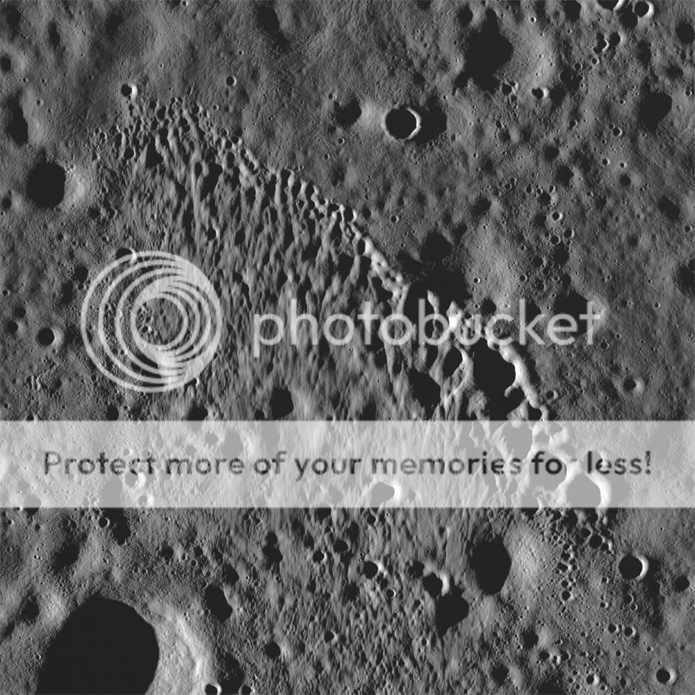
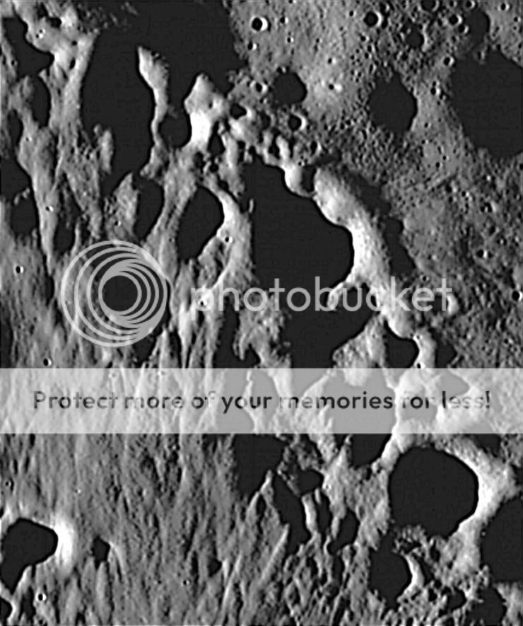
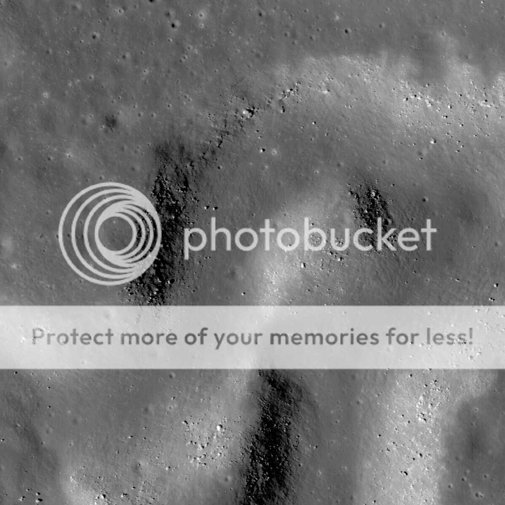
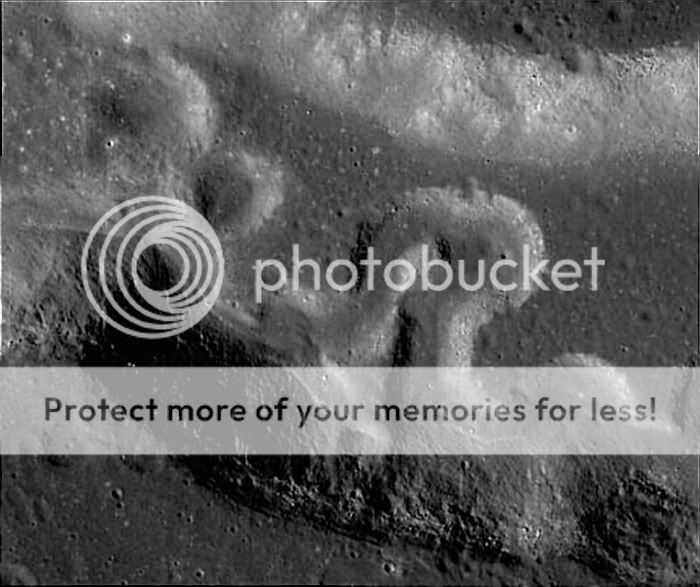
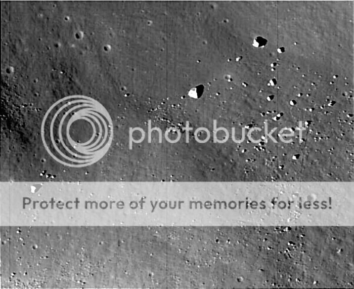
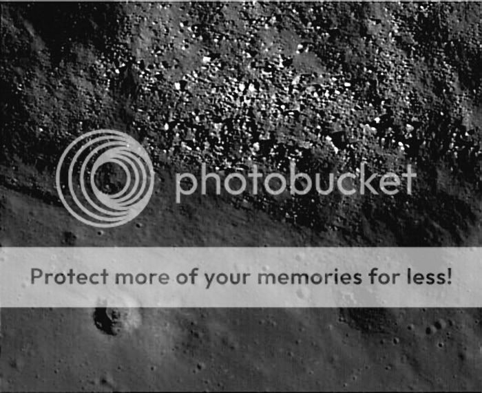
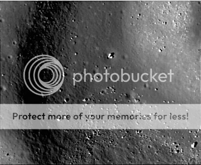
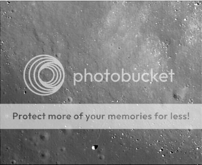
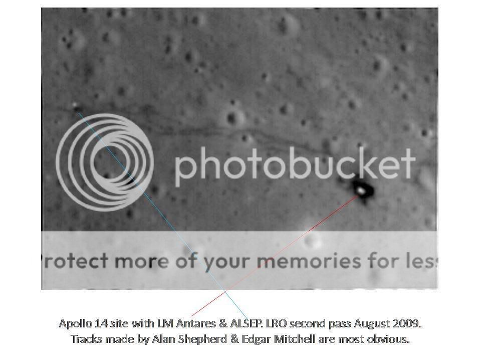
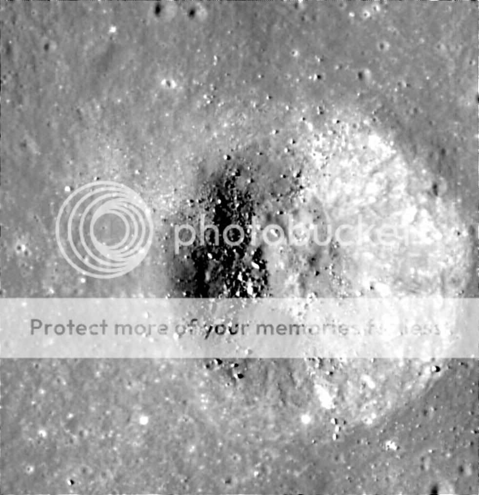
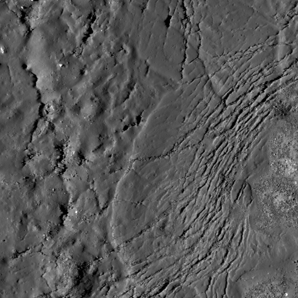
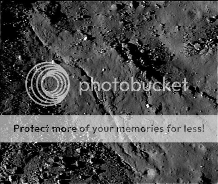
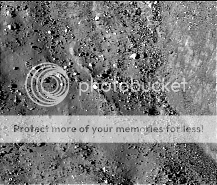
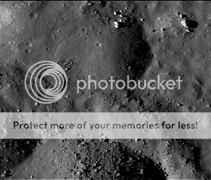
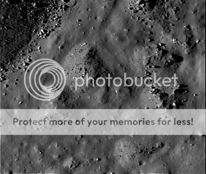
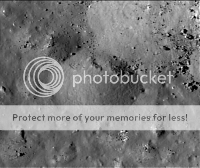
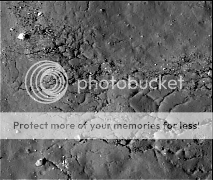
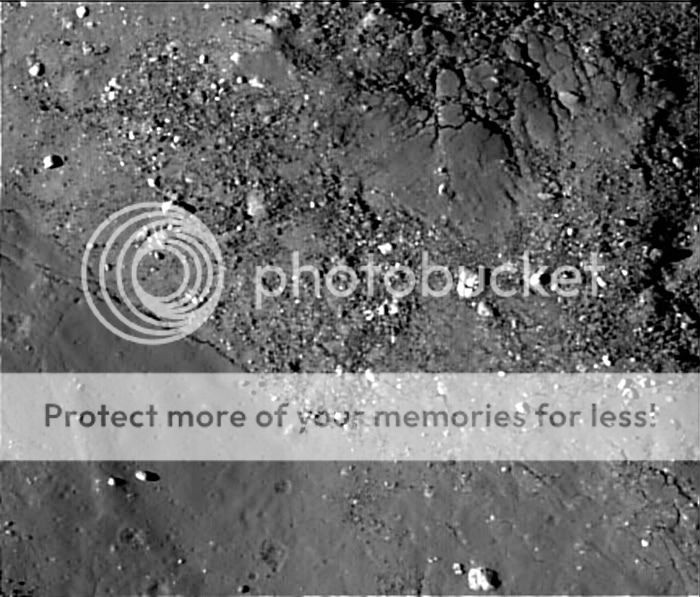
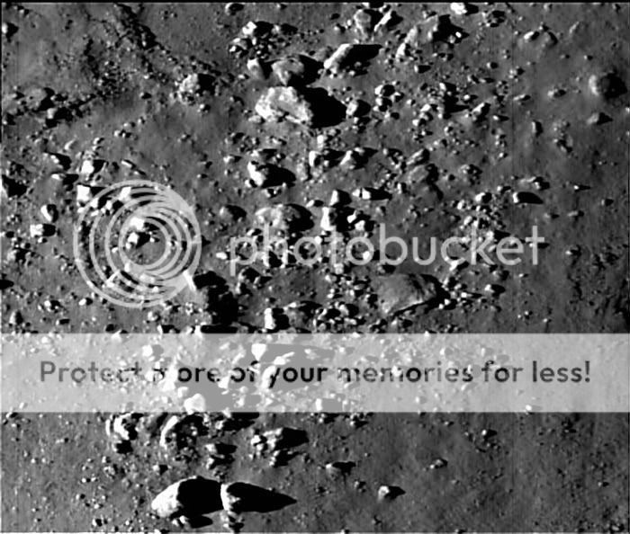
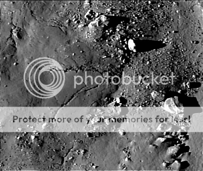
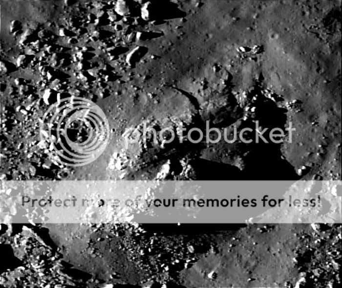
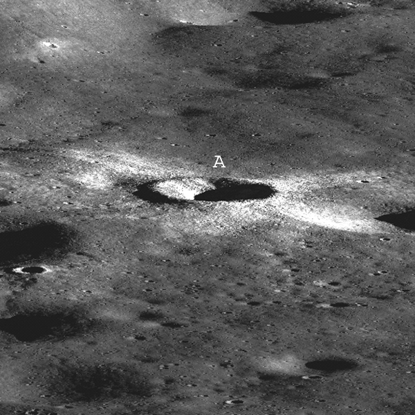
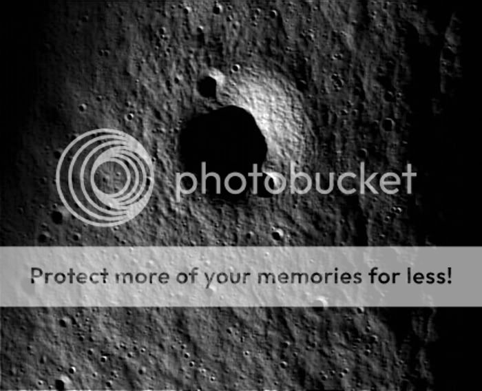
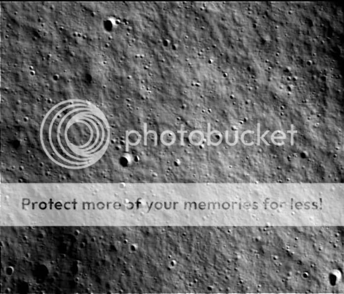
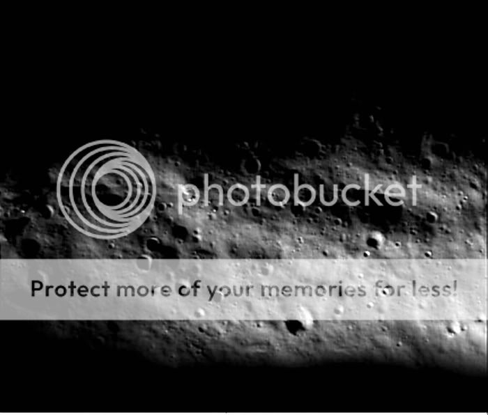
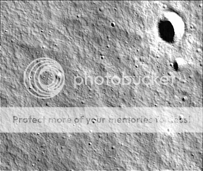
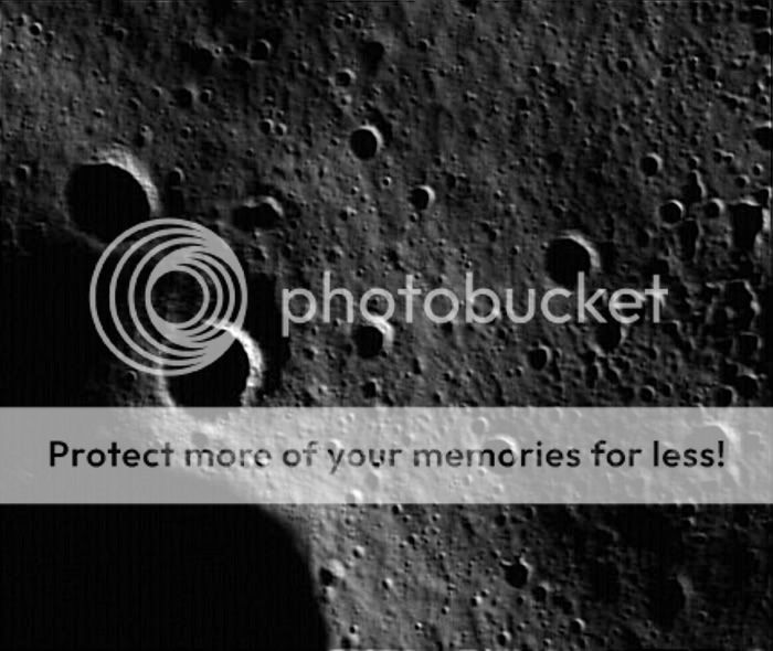
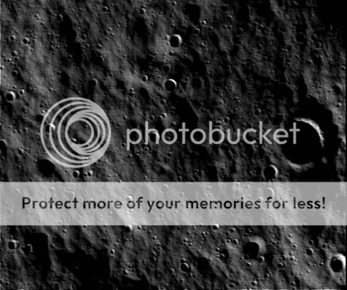
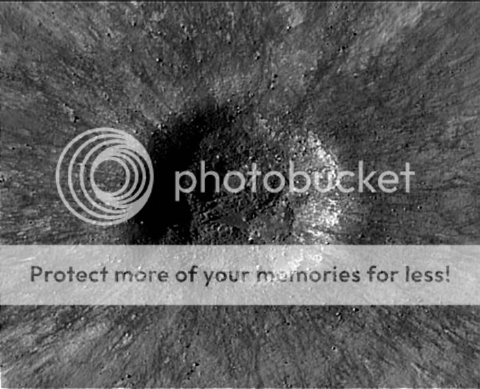
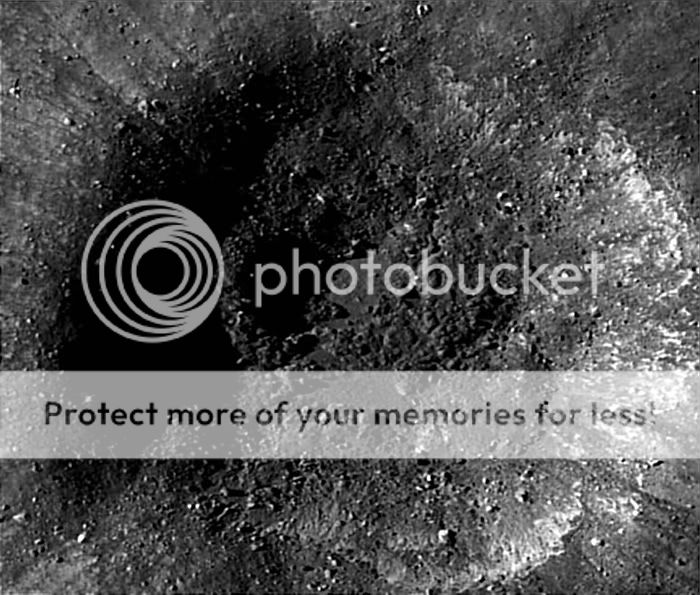
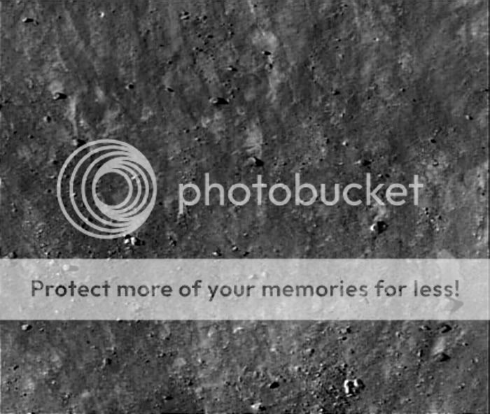
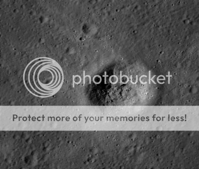
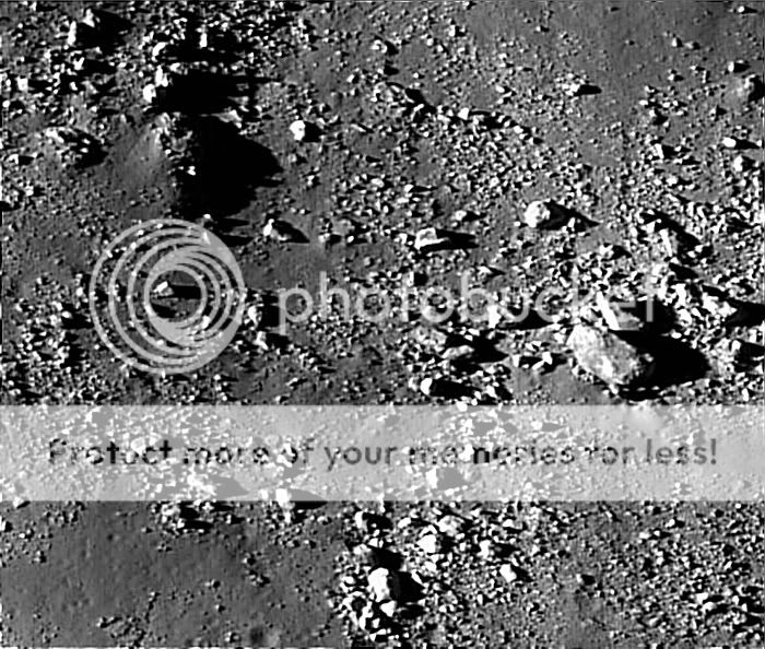
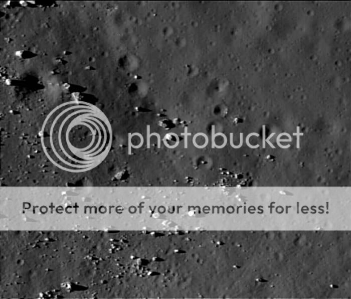
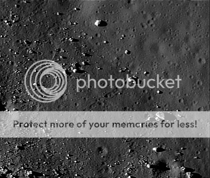
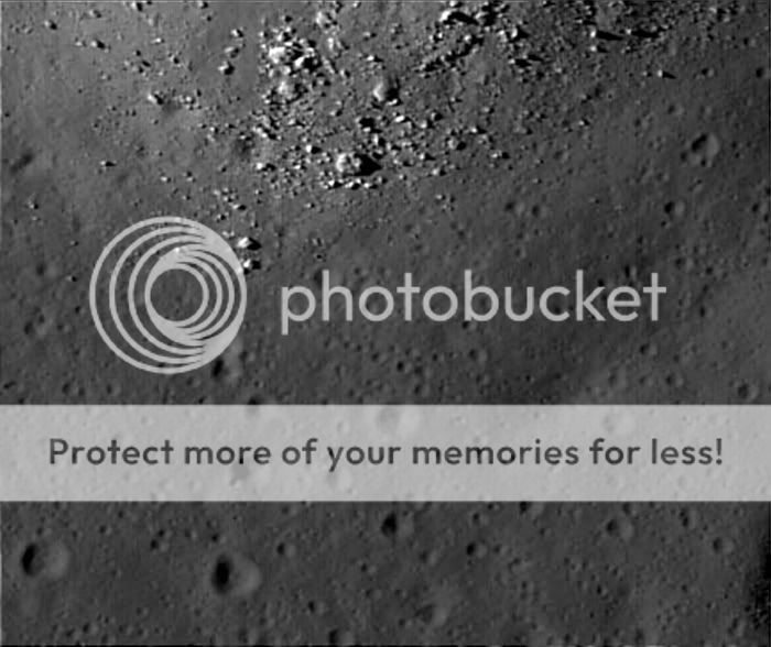
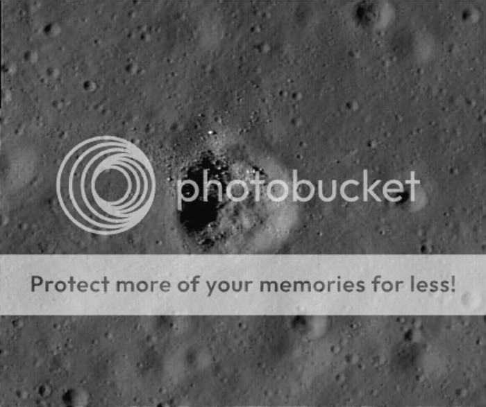
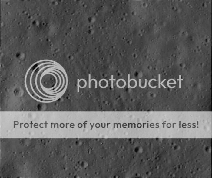
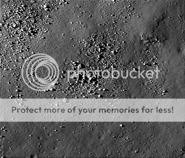
The Lunar Reconnaissance Orbiter Camera is providing high-resolution images of permanently shadowed regions while lighting conditions change as the moon's south pole enters lunar summer.

LRO's Lyman Alpha Mapping Project, or LAMP, also is preparing to search for surface ice and frost in the polar regions. The instrument provides images of permanently shadowed regions illuminated only by starlight and the glow of interplanetary hydrogen emission. LAMP has provided information to confirm the instrument is working well on both the lunar night and day sides.

The Mini RF Technology Demonstration on LRO has confirmed communications capability and produced detailed radar images of potential targets for LRO's companion mission, the Lunar Crater Observation and Sensing Satellite, which will impact the moon's south pole on Oct. 9.

Meanwhile, LRO's Cosmic Ray Telescope for the Effects of Radiation instrument is exploring the lunar radiation environment and its potential effects on humans during record high, "worst-case" cosmic ray intensities accompanying the extreme solar minimum conditions of this solar cycle.
 
D

docm

Guest
Re: LRO/LCROSS Mission

Just a blurb that Fox News (cable) will have coverage.
 
K

kelvinzero

Guest
Re: LRO/LCROSS Mission

How long should it take to get a reliable interpretation of the results?
 
M

MeteorWayne

Guest
Re: LRO/LCROSS Mission

Of course full, quantitative results will take a while, probably weeks to months, but it depends on how strong a signal there is.

If the signal of water is strong enough a qualitative statement may be possible very quickly, but I'm not betting on that.

Perhaps that question will be addressed in todays News Conference at 1 PM EDT.
 
C

centsworth_II

Guest
Re: LRO/LCROSS Mission

Looks like the LCROSS conference has been changed to 2:30 PM EDT. LINK

Thursday, Oct. 8, 2:30 p.m. EDT

LCROSS Pre-Impact Briefing

NASA will hold a pre-impact media teleconference on Thursday, Oct. 8 at 2:30 p.m. from NASA's Ames Research Center at Moffett Field, Calif., which will provide a mission update and discuss what to expect as the Centaur upper stage rocket and the LCROSS spacecraft impact Cabeus crater, near the lunar south pole.

Briefing participants:
- Daniel Andrews, LCROSS project manager, Ames
- Anthony Colaprete, LCROSS project scientist and principal investigator, Ames
- Jennifer Heldmann, coordinator for the LCROSS observation campaign, Ames

* A link to the streaming audio will appear here before the event.
 
Status
Not open for further replies.

TRENDING THREADS

Latest posts